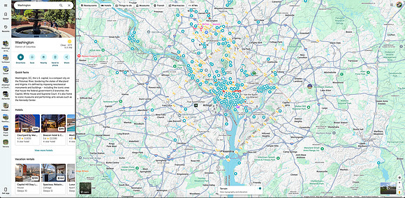
Google Maps screenshot showing the area around Washington DC, USA. Personalized as you can see from all the pins, I suppose it could also be interpreted as my visual bucket list of places to visit. Heavily concentrated in the downtown core of DC, then Northwest out towards Bethesda, Maryland, as my home town.
It is however always a work in progress. I would like to visit more of Virginia for example, just needs to be timed carefully as traffic can be a nightmare around the Beltway. That winding Potomac River might look pretty, but when there's only one bridge nearby that will take me over to Virginia from Maryland, it can get congested very fast, especially during rush hour.
In any case, it's interesting to think how a simple river can affect my daily travel habits. My mind can wander and imagine that Potomac River like an epic moat separating me from the enchanted Commonwealth of Virginia 🤭 Lots of interesting history there, and the colors are particularly nice around Shenandoah in autumn. Meanwhile, there's never any shortage of places to visit on the Maryland / Washington DC side of the river 👍
Credits to
Google Maps for providing the underlying map in Terrain view. Please note this screenshot is purely for personal research, and prints have been disabled as a result.